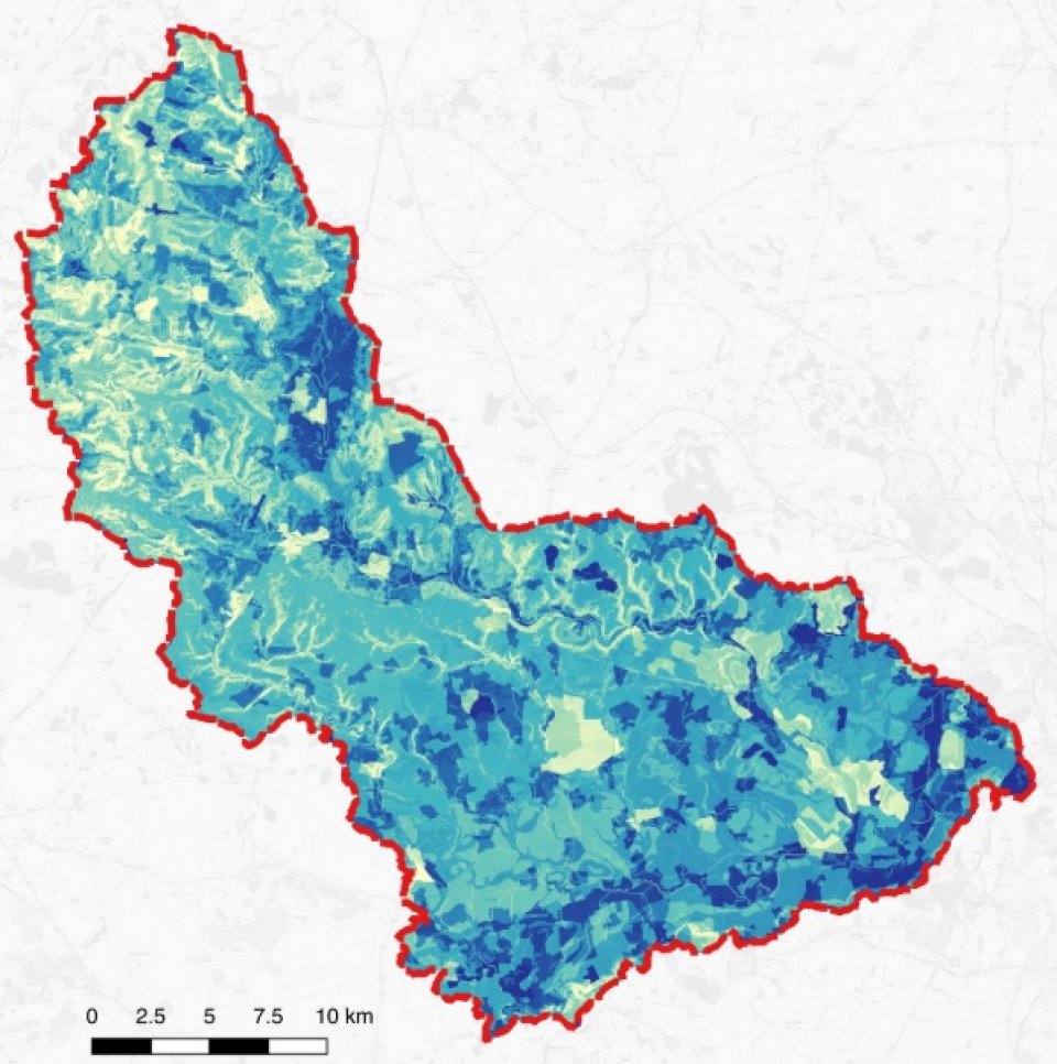
The Windrush flows through Oxfordshire and Gloucestershire, surrounded by a lowland catchment of approximately 750 km2. The river drains towards the lowland in the southeast, flowing toward Oxford. The surrounding land is principally occupied by pastures and non-irrigated arable land interspersed with woodland and urbanised land.
Viridian were asked to model an entire lowland catchment of approximately 750 km2 for a basket of ecosystem services, so the client could better understand where to focus effort on the ground, assist with planning, inform stakeholder engagement and influence policy formation.
Viridian sourced all data (mainly open source), carried out all modelling and created both datalayers and final maps for the client. The modelling combined hydraulic flows, vegetation interactions and soil effects to rank every 5m pixel across the catchment for its current ability to reduce flooding, diffuse pollution, erosion/sedimentation, and to improve groundwater recharge. Whole flow paths across the landscape were then analysed to understand where interventions would make the most impact on local problems, then understand which habitat types should be created on those locations to optimise the benefits.
The output datalayers ranked every 5m pixel for the degree of impact it offered by optimising its habitat type, so it was simple to identify where actions should be targeted. Where the most effective interventions were not possible due to local considerations, the next effective locations could be considered and so on until agreement was reached. Datalayers were produced for each service individually, as well as the most effective compromise for provision of all services simultaneously.
Some example of output maps can be viewed here http://viridianlogic.com/windrush-catchment-scale-planning/
This was a commercial application of ecosystem service modelling. The client - a wildlife trust - wanted to understand how improving natural habitats within the catchment could also improve ecosystem services, especially around water quantity and quality. This could be used for decision support on conservation activities and to engage stakeholders beyond environmental conservation. Such stakeholders included landowners for wider benefits of landuse change, funders for PES (including natural flood management), residents for active involvement, and regulators for policy support.
The outputs were particularly useful for these objectives, since the model ranked every 5m pixel across the catchment for its ability to improve local problems through nature based solutions, but did so using whole flow paths across the entire landscape. It also showed which habitat type should be created in each location. This meant that the optimising of ecosystem services could be balanced with other local priorities, restrictions and trade-offs. The understandable, visual presentation of results facilitated discussions with non-technical parties to achieve agreement.
The modelling was developed from the Natural Capital Project's RIOS system, and is appropriate for international use. Many of the datasets currently used are European or world-wide in scope. The outputs are in simple GIS format, so can be integrated with any other such modelling or surveys, including wider ecosystem service analyses. The model has been applied in mountainous, upland and lowland settings. It could be applied to urban setting, with appropriate data provision.
The prioritisation of impact gives a much richer result than the normal GIS opportunity mapping. It is important to keep output maps simple to understand. Quantification of flood reductions from NbS would be useful; this is now being developed by Viridian.

